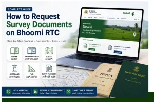
How to Request Survey Documents on Bhoomi RTC Guide
When was the last time you verified the exact boundaries of your land?
Most landowners in Karnataka rely on their RTC and leave it at that. But an RTC only tells you who owns the land — not where it starts, where it ends, or how big it really is. For that, you need Request survey documents. And thanks to the Bhumi RTC portal, you no longer have to hunt for them at a government office.
Whether you’re dealing with a boundary dispute, planning to buy a property, or just want to know the full story of your land — this guide tells you about every survey document available for the land, what each one means, and how to apply for a certified copy online in just a few steps.
What Are Survey Documents on Bhoomi RTC?
If you own land in Karnataka, you’ve probably heard of the Land RTC portal – the state government’s digital platform for land records. Most people use it to check their RTC (Pahani), track mutation status, or download the Khata extract. But there’s another feature on this portal that very few landowners know about: the ability to request survey documents online.
Request Survey documents aren’t like your regular RTC. While an RTC tells you who owns a parcel of land and what crops are grown on it, survey documents go into much greater depth. – They tell you exactly where the land is, how large it is, and what its precise boundaries are. These are the original records created by official surveyors when the land was first measured and mapped, sometimes decades ago.
Obtaining these documents means going in person to the Office of Survey Settlement and Land Records (SSLR), waiting in long lines, and hoping that the right staff member is available. Today, the Bhumi Portal – along with its companion platform Mojini V3 – has digitized this entire process, made it transparent, and accessible from your phone or laptop.
Why Would You Need Survey Documents?
Before diving into the how, it helps to understand the why. Survey documents are needed in several common situations:
Types of Survey Documents You Can Request on Bhoomi
The Bhoomi portal and Mojini V3 together allow citizens to apply for six types of survey documents. Here is what each one means in plain language:
Tippan
Tippan is the original field measurement book created during the land settlement survey. It contains the linear measurements, angles, and offsets that the surveyor physically recorded when he visited your land. Think of it as the official surveyor’s raw, handwritten field notes. It is regarded as one of the two “mother documents” of land measurement in Karnataka, and courts give it the highest importance in boundary disputes.
Survey Pakka Book
After the field survey was completed, the Tappan data was verified and entered into the Survey Paka Book—the final register of approved measurements. While the Tappan is the rough field record, the Paka Book is the cleaned-up, government-approved version. It is an important document for resolving disputes over land area.
Atlas
An atlas is a collection of maps that visually displays the arrangement of all survey numbers within a village. If you want to see the shape of your land, its position relative to neighboring plots, and where it lies within the village boundaries, the atlas is your document. It is especially useful for land buyers and those planning construction or development.
Akarband
Akarband area and assessment register – Karnataka’s two “mother documents” The second of Karnataka’s two “mother documents.” It records the total area of each survey number, how the land is classified (wetland, dryland, barren land), and the assessed revenue assigned to it. It is essential for tax-related matters and revenue administration.
FMB — Field Measurement Book
The Field Measurement Book contains detailed field drawings and measurements of individual survey numbers. Unlike Tippan, which covers large areas, the FMB focuses on specific plots with exact graphical detail. It is widely used for verifying technical boundaries and in legal proceedings.
Survey Prati Book
The survey parcel book is a record of past survey details and any amendments made to the land record over time. If your land has been resurveyed, subdivided, or otherwise modified, this document tracks that history. It helps you understand how a parcel of land has changed from its original surveyed condition.
How to Request Survey Documents on Bhoomi: Step-by-Step
You can request these documents through two official routes — the main Bhoomi portal and the Mojini V3 platform.
Method 1: Through the Bhoomi Portal
Step 1: Open your browser and go to the official Bhoomi land records portal at landrecords.karnataka.gov.in.
Step 2: On the homepage, look for the “Survey Documents” section. You will find two options — “View Survey Documents” (free, for reference only) and “Request for Survey Documents” (for certified copies, with a fee).
Step 3: Click on “Request for Survey Documents” and log in to your Bhoomi citizen account. If you do not have an account, register using your mobile number and basic details.
Step 4: Select the type of document you need from the list — Tippan, Pakka Book, Atlas, Akarband, FMB, or Survey Prati Book.
Step 5: Enter your land details — District, Taluk, Hobli, Village, Survey Number, Surnoc, and Hissa Number.
Step 6: Review the details carefully and proceed to pay the applicable fee online. The fee for most survey documents is approximately ₹15, though this may vary.
Step 7: After payment, note down your application reference number. You will need this to track your request.
Method 2: Through Mojini V3
The Mojini V3 portal at bhoomojini.karnataka.gov.in is the dedicated platform for survey-related services in Karnataka. It works alongside Bhoomi and is particularly useful for tracking survey requests, partitioning applications, and sketch-related services.
To use Mojini V3 for survey documents, visit the portal, select the relevant service, enter your survey details, pay the fee, and track the status using your application number, mobile number, or survey number.
How to Track Your Application Status
After submitting your request, you do not have to wait in uncertainty. Tracking is straightforward:
Viewing Survey Documents for Free (Without Applying)
The survey parcel book is a record of past survey details and any amendments made to the land record over time. If your land has been resurveyed, subdivided, or otherwise modified, this document tracks that history. It helps you understand how a parcel of land has changed from its original surveyed condition.
What Is the Difference Between Viewing and Requesting?
This is a question many people get confused about. Here is a simple breakdown:
| Feature | View Survey Documents | Request Survey Documents |
| Purpose | For reference and checking | For certified official copies |
| Fee | Free | ₹15 (approximately) |
| Legal validity | Not valid for legal/official use | Certified copy, valid officially |
| Who needs it | Anyone doing basic research | People with legal, financial, or official needs |
Why This Service Matters for Karnataka Landowners
Before the Bhumi Portal was launched in 2000, accessing survey documents meant physically going to the SSLR office, dealing with intermediaries, and sometimes waiting weeks for documents stored in aging paper registers. The risk of errors, tampering, and delays was significant.
Today in Karnataka, any landowner can sit at home, enter their survey details, pay a nominal fee online, and obtain certified copies of documents that carry full legal validity. It has not only made the process faster but has also made land administration more honest, transparent, and fair for everyone.
For farmers applying for loans, buyers verifying before purchase, families settling inheritance disputes, or individuals fighting encroachments — the ability to apply online for survey documents is a real game changer.
